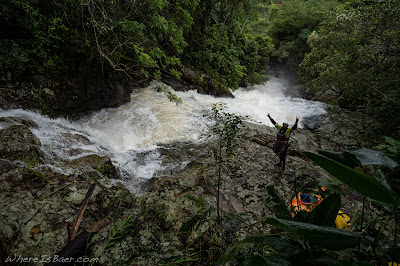
Descending toward the perpetual roar of whitewater, with sweat flowing off your brow and into your eyes, vegetation obscuring the already undistinguishable “trail,” jungle navigation is never elegant. There is the expected amount of cursing, tripping, and slipping.
 |
| Rudnei Ribeiro enjoying some ocean time |
What you would assume to be a secure foot placement crumbles into a slick mud skid. Balance falters and that once stable foot is now in the air, your butt is now in the slippery mud and you are starting to pick up speed, sliding through the jungle. You reach out, grabbing for trees, branches, vines, or anything which might slow your descent. “Damn those were thorns”, expletive, thud, expletive! You come to an abrupt stop, relieved that the boulder you smashed into was in its precarious location.
Perfecting the balance necessary to descend this kind of terrain is possible. However, dragging a 9ft kayak with one hand, a 201cm paddle in the other, along with encumbering yourself with the entanglement opportunities of a pfd, helmet, skirt, and GoPro, make these advances a torturous excursion. All of this stumbling around in the Brazilian jungle has led to some spectacular rivers, many of which have little or no written beta. Here is a quick low-down on a few notable sections:
Ribeirão do Braço Grande
Put In: GPS (-24.09578386090188, -47.254910219123175) Note: Follow feeder creek to main river
Take Out: GPS (-24.120205688341642, -47.26647569261122) Note: There is a house on river right
Class: 4
Flow: Visual, consistent light rain (that is very common) will be enough to have good flow.
Run Description: Bedrock slides, ledges, portages, and a few boulder gardens. Access for this section is a thirty minute hike down the side of a mountain with no trail. Quality rapids start immediately. After half a dozen solid rapids, the river relents back into meandering riffles and overhanging vegetation dodging.
“Little Hell” section of the Rio Inferninho Quinta dos Ganchos
Put In: GPS (-27.36381508850432, -48.75438122944922) Note: Small wooden bridge
Take Out: GPS (-27.364597510074283, -48.740676968134) Note: Large dome slide
Class: 5
Flow: Visual, heavy rain needed to have flows above boat abusive levels.
Run Description: Bedrock slides and waterfalls, rapids are large. Multiple portages (60 foot waterfall landing on a rock shelf). Scout every horizon line.
Multiple sections
Take Out: GPS (-27.364597510074283, -48.740676968134) Note: Large dome slide
Class: 5
Flow: Visual, heavy rain needed to have flows above boat abusive levels.
Run Description: Bedrock slides and waterfalls, rapids are large. Multiple portages (60 foot waterfall landing on a rock shelf). Scout every horizon line.
 |
| Renato Costa Guimarães on Little Hell |
 |
| Rudnei Ribeiro behind the camera capturing Chris Baer on the first big slide of Little Hell |
Rio dos Cedros
Put In: GPS (-26.655205356249457, -49.35048029377008) Note: Dam
Take Out: GPS (-26.66130168294995, -49.33309718472249) Note: Power station
Class: 5+
Flow: Visual; gauge is currently offline: http://ceops.furb.br/restrito/SisCeops/views_pub/tabela_nivel.html search Rio dos Cedros on the site; usually dewatered due to dam
Run Description: Dam creates a fun auto-boof park and huck. The rest of the section is a sieve pile.
 |
| swing into the kayak bar just upstream of the historic bridge |
Put In: GPS (-26.66130168294995, -49.33309718472249) Note: Power station
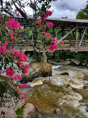
Take Out: GPS (-26.672412956279782, -49.32129836646087) Note: Historic bridge
Class: 4+
Flow: Visual; gauge is currently offline: http://ceops.furb.br/restrito/SisCeops/views_pub/tabela_nivel.html search Rio dos Cedros on the site; large watershed, usually flowing
Run Description: Rapids and rocks come at you quickly with long, boulder choked rapids. A local guide can make the difference between this being a quick lap or an all-day scouting mission.
 |
| historic bridge over the Rio dos Cedros |
Put In: GPS (-26.672412956279782, -49.32129836646087) Note: Historic bridge
Take Out: GPS (-26.672479012772477, -49.320825566464634) Note: Small footbridge
Class: 5
Flow: Visual; gauge is currently offline: http://ceops.furb.br/restrito/SisCeops/views_pub/tabela_nivel.html search Rio dos Cedros on the site; large watershed, usually flowing
Run Description: If you enjoyed the section above, this is a step up. One massive sieve that is usually portaged river right, and two very bouncy boulder garden rapids.
 |
| private take out on the Rio dos Cedros |
Put In: GPS (-26.68411207759926, -49.31353274517334) Note: Small footbridge
Take Out: GPS (-26.701225044973278, -49.287494734592016) Note: Private, kayaker-owned farm
Class: 3+
Flow: Visual; gauge is currently offline: http://ceops.furb.br/restrito/SisCeops/views_pub/tabela_nivel.html search Rio dos Cedros on the site; large watershed, usually flowing
Run Description: A perfect warm-up stretch for this rocky river, or maybe just a cool-down after one of the upper sections.
Rio Garcia
Put In: GPS (-27.04832886973124, -49.0921790976178) Note: Gated park entrance
Take Out: GPS (-27.028249001720194, -49.0930442596256) Note: Small drivable bridge
Class: 4+
Flow: Visual; typically looks low, but the flow gets constricted in a micro-gorge
Run Description: Micro-creeking on the outskirts of Blumenau. Fun bedrock features. One big double drop that is usually portaged river right. Crystal clear water coming out of a national park. (Possibility of more good rapids upstream?)
 |
| Joao Gabriel Araujo scouting the "portage" on the Rio Garcia |
Itajaí-Açu River
Multiple sectionsNote: “Paradise” section further upstream has a much smaller flow window and is typically dewatered by a dam
 |
| looking down on the Itajaí-Açu River |
Put In: GPS (-27.080805786301287, -49.513652261165326) Note: Side of road pull-off
Take Out: GPS (-27.076767560704273, -49.435098606638086) Note: Ativa Rafting Company
Class: 4
Flow: http://ceops.furb.br/restrito/SisCeops/views_pub/tabela_nivel.html search Apiúna on the site. Range: Low 1.0 meter - High 2.6 meters
Run Description: Spectacular big water fun. A few steep ledges should be scouted. The general characteristic of the river is read and run big, rolling waves.
 |
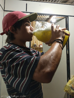
| Joao Gabriel Araujo enjoying a fairly large caiparinia |
Put In: GPS (-27.08034395994515, -49.442244208502295) Note: Looks like small private driveway
Take Out: GPS (-27.076767560704273, -49.435098606638086) Note: Ativa Rafting Company
Class: 3-4 with an enormous flow window
Flow: http://ceops.furb.br/restrito/SisCeops/views_pub/tabela_nivel.html search Apiúna on the site. Range: Low 1.0 meter - High 3.5 meters
Run Description: Large volume bedrock ledges. Fun class 3 at low water, huge dynamic waves at high water.
 | ||||||||||||||||||||||||||||||||||||||||||||||||||||||||||||||||||||||||||||||||||||||||||||||||||||||||||||||||||||||||||||
| adventure by Chris Baer |


No comments:
Post a Comment